MapBox-compatible file formats and limitations
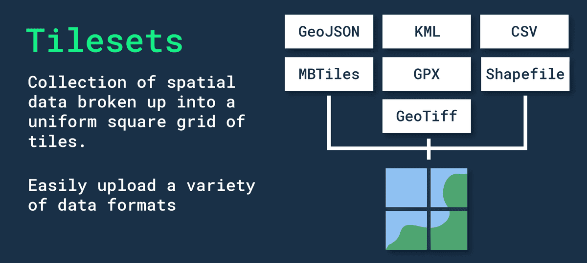
In general, the file formats used for representing geospatial data have similar advantages and we should focus on their limitations relative to our current dataset:
| File Format | Advantages | Limitations |
|---|---|---|
| MBTile | Compact, can store large amounts of data in a single file, suitable for offline mapping | Limited to raster data, does not support vector data |
| KML | Can contain a variety of data types, easy to share, can be opened in a variety of mapping applications | Large file size, may not be suitable for large datasets |
| GPX | Can store GPS data for activities such as hiking, biking, and running, easy to share, can be opened in a variety of mapping applications | Limited to GPS data, does not support other types of geospatial data |
| GeoJSON | Can store vector data, compact and easy to share, can be opened in a variety of mapping applications | Can be larger than other formats, may not be suitable for large datasets |
| Shapefile | Widely supported, can store geospatial vector data, can be used for mapping and analysis | Complex, requires specialized software to create and edit |
| CSV | Simple, widely supported, can be used for geospatial data by including latitude and longitude coordinates in the table | Does not support complex geospatial data types, may not be suitable for advanced mapping and analysis |
Anyway, MapBox Studio convert any input file format into their own proprietary tileset file format. This case we have new limitations for each of the file formats:
| File type | Datasets | Tilesets | Transfer limits |
|---|---|---|---|
| CSV | ✔ | ✔ | 5 MB for datasets 1 GB for tilesets |
| GeoJSON | ✔ | ✔ | 5 MB for datasets 1 GB for tilesets |
| GeoTIFF | ✔ | 10 GB | |
| GPX | ✔ | 260 MB | |
| KML | ✔ | 260 MB with 15 layers or fewer | |
| MBTiles | ✔ | 25 GB | |
| Shapefile | ✔ | 260 MB (combined uncompressed size of .shp and .dbf files). You must upload shapefiles as a compressed (.zip) file. |
If you run into the 300 MB file limit when uploading via Studio, see the tileset upload errors section for suggested solutions.
Комментарии
Отправить комментарий